It's important to have clues, a priori, from where certain species of mosquitoes can grow, since this is the key to deploying their larval control.
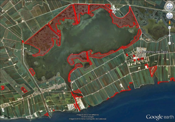
The Ebro Delta, like other wetland territories, seem at first glance to be large homogeneous areas of land, with a very marked flat zone component and with the presence of water, more or less permanent as fundamental features.
Studying this plain more carefully we realize that it's not quite so. The presence of various plant communities clearly show us a very different gradient of soils, salinity and hydric regime.
These microspaces are those that the various species of mosquitoes have taken advantage of for their spatial segregation.
Using vegetation as a revealing element of certain edaphic and physical-chemical conditions of the space, it's possible to create a thematic cartography for mosquito control.
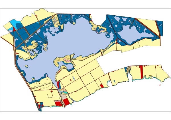
This cartography is the key and basic element, since it shows us the potential of the territory to develop some and not other species of mosquitoes.
The Ebro Delta, like all coastal areas in general, are highly mobile and transformable areas, especially if they present significant human activity. This forces us to allocate an important part of our activities to constantly review the thematic cartography.
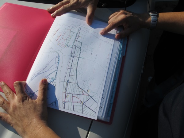
The necessary field work is accompanied by other supports such as satellite images or aerial photographs that are very useful in areas of difficult access.
These tasks are usually done in the winter months and are complemented in the summer months as a logical complement to the larval surveys of the already predetermined foci.
All this information is transmitted to computer-aided drawing programs, where the areas of the larval foci are calculated, and any possible intervention (prospecting, treatment) will use this information as a base.